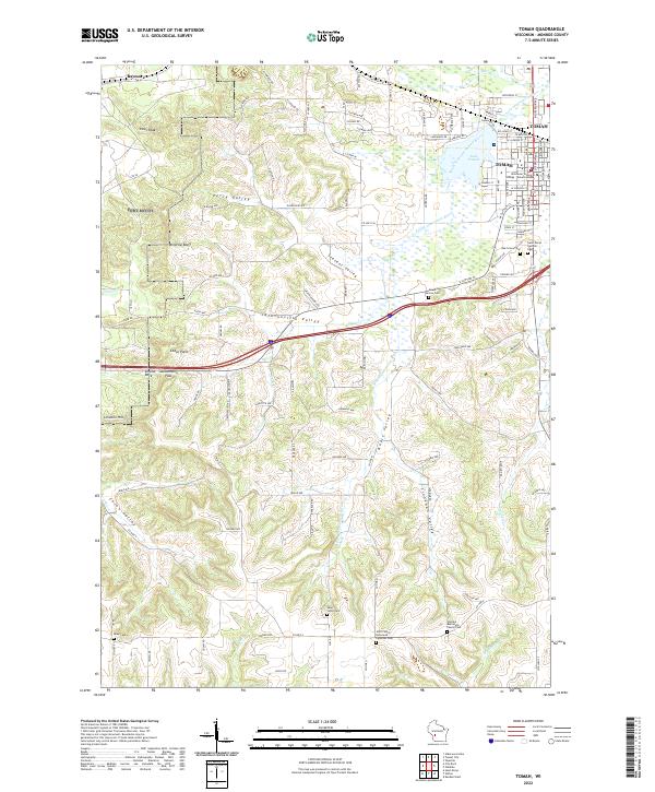
2022 Map of Tomah
USGS Topo · Published 2022About this map
The city of Tomah serves as the focal point of this 2022 survey, showcasing the modern urban layout centered around Lake Tomah and the South Fork Lemonweir River. The map highlights a significant academic presence with the Wisconsin Technical College - Tomah Campus, while the surrounding rural landscape is defined by a dense network of valleys such as Jacksonville Valley and Linnehan Valley. Geologically, the area is punctuated by dramatic rises like Windrow Bluff and Pikes Peak, alongside local landmarks such as Engine Rock and Jacksonville Pass.
Find a feature on this map
165 named features on this map. Tap any name to fly to it.
Don’t see what you’re looking for? This feature index may not catch every label — zoom into the map to look around manually.
Map Details
Editions of this 2022 Tomah Map
This is the sole edition of this map. No revisions or reprints were ever made.
Other maps of this area

1916 · Tomah
USGS Topo · 1:62,500

1919 · Kendall
USGS Topo · 1:62,500

1921 · Kendall
USGS Topo · 1:62,500

1947 · Millston
USGS Topo · 1:62,500

1949 · Millston
USGS Topo · 1:62,500

1949 · Tomah
USGS Topo · 1:62,500

1953 · Eau Claire
USGS Topo · 1:250,000

1958 · Eau Claire
USGS Topo · 1:250,000

1958 · Wyeville
USGS Topo · 1:48,000

1958 · La Crosse
USGS Topo · 1:250,000