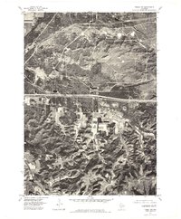
1976 Map of Tomah NW
USGS Topo · Published 1978About this map
Old Camp Mc Coy occupies a prominent portion of this Monroe County landscape, shown here via orthophoto imagery from the mid-1970s. This aerial perspective reveals the complex intersection of military training grounds and rural Wisconsin agriculture. The terrain is bisected by the La Crosse River in the north and Silver Creek flowing through the center, both cutting through a mix of dense woodlands and open fields. The map provides an overhead look at the division between government-held lands and the surrounding farmsteads, characterized by the distinct rectangular patterns of cleared acreage and the infrastructure of the major roadway corridor that cuts east to west across the center of the sheet.
Find a feature on this map
3 named features on this map. Tap any name to fly to it.
Don’t see what you’re looking for? This feature index may not catch every label — zoom into the map to look around manually.
Map Details
Editions of this 1976 Tomah NW Map
This is the sole edition of this map. No revisions or reprints were ever made.
Other maps of this area

1909 · Sparta
USGS Topo · 1:62,500

1916 · Tomah
USGS Topo · 1:62,500

1928 · Melrose
USGS Topo · 1:48,000

1947 · Millston
USGS Topo · 1:62,500

1947 · Sparta
USGS Topo · 1:62,500

1949 · Millston
USGS Topo · 1:62,500

1949 · Sparta
USGS Topo · 1:62,500

1949 · Tomah
USGS Topo · 1:62,500

1949 · Melrose
USGS Topo · 1:62,500

1953 · Eau Claire
USGS Topo · 1:250,000