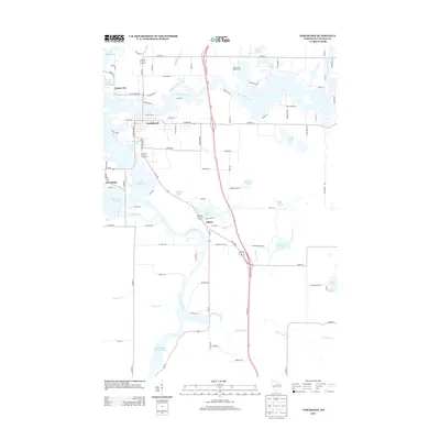
2013 Map of Tomahawk
USGS Topo · Published 2013About this map
The Wisconsin River serves as the central artery for this Lincoln County landscape, winding south past Tomahawk and Jersey City into the wide expanse of Lake Mohawksin. This 2013 survey illustrates a region defined by complex waterways and timber-era settlements, where the river system is augmented by the Spirit River Flowage and the regulated waters of Grandmother Flowage 2269. The local topography is punctuated by numerous glacial lakes including Skanawan Lake and LaCerte Lake, alongside recreational landmarks like Bradley Park and the Maple Birch Golf Course.
Find a feature on this map
88 named features on this map. Tap any name to fly to it.
Don’t see what you’re looking for? This feature index may not catch every label — zoom into the map to look around manually.
Map Details
Editions of this 2013 Tomahawk Map
This is the sole edition of this map. No revisions or reprints were ever made.
Other maps of this area

1939 · Mc Cord
USGS Topo · 1:48,000

1939 · Cassian
USGS Topo · 1:48,000

1942 · Cassian
USGS Topo · 1:48,000

1947 · Mc Cord
USGS Topo · 1:48,000

1950 · Tomahawk
USGS Topo · 1:48,000

1950 · Spirit Falls
USGS Topo · 1:48,000

1952 · Spirit Falls
USGS Topo · 1:48,000

1952 · Tomahawk
USGS Topo · 1:48,000

1954 · Iron Mountain
USGS Topo · 1:250,000

1959 · Iron Mountain
USGS Topo · 1:250,000