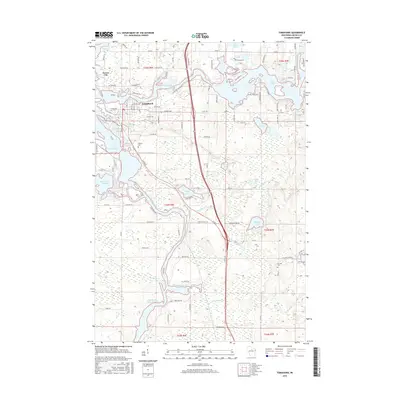
2015 Map of Tomahawk
USGS Topo · Published 2015About this map
Tomahawk and Jersey City sit at the confluence of several major waterways, forming a complex landscape defined by the Wisconsin River and its varied flowages. This 2015 survey illustrates how the local geography is shaped by the damming of rivers, creating large water bodies such as Spirit River Flowage and Grandmother Flowage 2269. The dense network of lakes, including Lake Alice, Lake Mohawksin, and the Twin Lakes, suggests a region deeply tied to water-based industry and recreation.
Find a feature on this map
104 named features on this map. Tap any name to fly to it.
Don’t see what you’re looking for? This feature index may not catch every label — zoom into the map to look around manually.
Map Details
Editions of this 2015 Tomahawk Map
This is the sole edition of this map. No revisions or reprints were ever made.
Other maps of this area

1939 · Mc Cord
USGS Topo · 1:48,000

1939 · Cassian
USGS Topo · 1:48,000

1942 · Cassian
USGS Topo · 1:48,000

1947 · Mc Cord
USGS Topo · 1:48,000

1950 · Tomahawk
USGS Topo · 1:48,000

1950 · Spirit Falls
USGS Topo · 1:48,000

1952 · Spirit Falls
USGS Topo · 1:48,000

1952 · Tomahawk
USGS Topo · 1:48,000

1954 · Iron Mountain
USGS Topo · 1:250,000

1959 · Iron Mountain
USGS Topo · 1:250,000