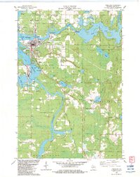
1982 Map of Tomahawk
USGS Topo · Published 1983About this map
Wisconsin River waters dominate this landscape, controlled by the Kings Dam Powerplant to create the expansive Lake Alice and Lake Mohawksin. The city of Tomahawk serves as the industrial and residential hub, situated where the river meets the Spirit River and Spirit River Flowage. The era's transportation network is defined by the Chicago Milwaukee St Paul and Pacific railroad, which threads through the town and southward past the settlement of Gilbert.
Find a feature on this map
61 named features on this map. Tap any name to fly to it.
Don’t see what you’re looking for? This feature index may not catch every label — zoom into the map to look around manually.
Map Details
Editions of this 1982 Tomahawk Map
This is the sole edition of this map. No revisions or reprints were ever made.
Other maps of this area

1939 · Mc Cord
USGS Topo · 1:48,000

1939 · Cassian
USGS Topo · 1:48,000

1942 · Cassian
USGS Topo · 1:48,000

1947 · Mc Cord
USGS Topo · 1:48,000

1950 · Tomahawk
USGS Topo · 1:48,000

1950 · Spirit Falls
USGS Topo · 1:48,000

1952 · Spirit Falls
USGS Topo · 1:48,000

1952 · Tomahawk
USGS Topo · 1:48,000

1954 · Iron Mountain
USGS Topo · 1:250,000

1959 · Iron Mountain
USGS Topo · 1:250,000