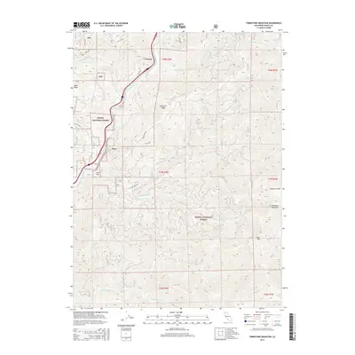
2015 Map of Tombstone Mountain
USGS Topo · Published 2015About this map
The Sacramento River carves a deep path through the western edge of the Shasta National Forest, defining the region's transport and settlement corridors. Small hamlets like Conant, Sims, and Sims Flat are clustered tightly along the river valley, where narrow strips of development follow the winding path of Conant Rd and the parallel rail corridor. This rugged mountain landscape is dominated by high ridges and peaks, most notably Tombstone Mountain in the east and the prominent Sweetbrier Ridge and Mears Ridge. A dense network of drainage systems, including Hazel Cr, Sweetbrier Cr, and Tom Neal Cr, feeds into the Sacramento from the surrounding heights. High-elevation landmarks like Tater Hill and Big Spring mark the interior, reachable via forestry routes like Girard Ridge Rd and the lower Hazel Creek Rd.
Find a feature on this map
32 named features on this map. Tap any name to fly to it.
Don’t see what you’re looking for? This feature index may not catch every label — zoom into the map to look around manually.
Map Details
Editions of this 2015 Tombstone Mountain Map
This is the sole edition of this map. No revisions or reprints were ever made.
Other maps of this area

1886 · Shasta
USGS Topo · 1:250,000

1890 · Red Bluff
USGS Topo · 1:250,000

1894 · Red Bluff
USGS Topo · 1:250,000

1894 · Shasta
USGS Topo · 1:250,000

1901 · Redding
USGS Topo · 1:125,000

1935 · Dunsmuir
USGS Topo · 1:125,000

1946 · Lamoine
USGS Topo · 1:62,500

1948 · Weed
USGS Topo · 1:250,000

1949 · Bollibokka Mtn
USGS Topo · 1:62,500

1950 · Weed
USGS Topo · 1:250,000