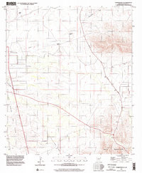
1996 Map of Tombstone SE
USGS Topo · Published 2002About this map
San Rafael National Riparian Conservation Area defines the western portion of this landscape, marking a protected corridor near the historic Grant Boundary and Pedro Valle. The terrain transitions from the seasonal drainage of Government Draw toward the rising slopes of the Mule Mountains in the southeast. This 1996 view of the Cochise County desert reveals a sparse network of working cattle operations, including Keller Ranch, Trappman Ranch, and Johnson Ranch, connected by Davis Road. Evidence of past infrastructure and industrial activity is visible through the Old Railroad Grade and several small pits, while the Jefferson Memorial Highway provides a modern transit artery through the basin.
Find a feature on this map
13 named features on this map. Tap any name to fly to it.
Don’t see what you’re looking for? This feature index may not catch every label — zoom into the map to look around manually.
Map Details
Editions of this 1996 Tombstone SE Map
This is the sole edition of this map. No revisions or reprints were ever made.
Other maps of this area

1902 · Bisbee
USGS Topo · 1:62,500

1910 · Bisbee
USGS Topo · 1:62,500

1914 · Hereford
USGS Topo · 1:125,000

1915 · Benson
USGS Topo · 1:125,000

1916 · Pearce
USGS Topo · 1:125,000

1916 · Douglas
USGS Topo · 1:125,000

1919 · Douglas
USGS Topo · 1:125,000

1925 · Gleeson
USGS Topo · 1:62,500

1927 · Bisbee
USGS Topo · 1:62,500

1932 · Stark
USGS Topo · 1:62,500