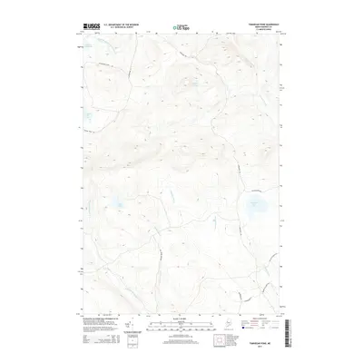
2014 Map of Tomhegan Pond
USGS Topo · Published 2014About this map
Tomhegan Pond and the surrounding timberlands of Somerset County define this remote landscape of the Maine North Woods as it appeared in 2014. The terrain is a complex network of glacial ponds and drainages, including the high-elevation Dipper Pond and the centrally located Center Pond. This sheet is dominated by an extensive network of logging and access roads that crisscross the backcountry, such as the Northern Rd, Old Middlesex Rd, and the Soldiertown Rd, illustrating the modern infrastructure supporting the region's long-standing forest products industry. Waterways like the South Branch Penobscot River in the northwest and Socatean Stream in the northeast frame the watershed. Local landmarks and unique road names like Toe of the Boot Rd and Drinkwater Rd suggest the localized history and nomenclature of the sports and camps traditionally found throughout this wilderness area.
Find a feature on this map
19 named features on this map. Tap any name to fly to it.
Don’t see what you’re looking for? This feature index may not catch every label — zoom into the map to look around manually.
Map Details
Editions of this 2014 Tomhegan Pond Map
This is the sole edition of this map. No revisions or reprints were ever made.
Other maps of this area

1921 · Brassua Lake
USGS Topo · 1:62,500

1922 · Long Pond
USGS Topo · 1:62,500

1923 · Brassua Lake
USGS Topo · 1:62,500

1924 · Long Pond
USGS Topo · 1:62,500

1944 · Brassua Lake
USGS Topo · 1:62,500

1944 · Long Pond
USGS Topo · 1:62,500

1949 · Jackman
USGS Topo · 1:250,000

1954 · Seboomook Lake
USGS Topo · 1:62,500

1954 · Millinocket
USGS Topo · 1:250,000

1956 · Penobscot Lake
USGS Topo · 1:62,500
Featured Places
- West Middlesex Canal Grant Township, ME
- Brassua Township, ME
- Pittston Academy Grant, ME
- Tomhegan Township, ME
- Plymouth Township, ME