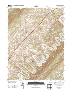
2013 Map of Toms Brook
USGS Topo · Published 2013About this map
The N Fork Shenandoah River meanders through the heart of the Shenandoah Valley, carving deep oxbows around Rittenour Ridge and Cox Ridge. This 2013 topographic study documents a landscape defined by its agricultural valleys and prominent ridges, including the rising elevations of Green Mountain and Fishers Hill. Small settlements such as Toms Brook and Maurertown sit along the primary transport corridor, while more secluded locations like Saumsville and Pelton are tucked further into the terrain.
Find a feature on this map
131 named features on this map. Tap any name to fly to it.
Don’t see what you’re looking for? This feature index may not catch every label — zoom into the map to look around manually.
Map Details
Editions of this 2013 Toms Brook Map
This is the sole edition of this map. No revisions or reprints were ever made.
Other maps of this area

1891 · Romney
USGS Topo · 1:125,000

1892 · Woodstock
USGS Topo · 1:125,000

1893 · Luray
USGS Topo · 1:125,000

1894 · Winchester
USGS Topo · 1:125,000

1905 · Luray
USGS Topo · 1:125,000

1922 · Wardensville
USGS Topo · 1:62,500

1923 · Middletown
USGS Topo · 1:62,500

1923 · Edinburg
USGS Topo · 1:62,500

1924 · Wardensville
USGS Topo · 1:62,500

1937 · Middletown
USGS Topo · 1:48,000