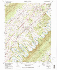
1994 Map of Toms Brook
USGS Topo · Published 1997About this map
The North Fork Shenandoah River carves a dramatic path through this section of the Shenandoah Valley, most notably forming the famous Seven Bends south of Woodstock. This landscape is defined by the tight relationship between the winding river and the parallel ridges of Three Top Mountain and Little North Mountain. The valley floor is dotted with long-established communities and rural institutions, including the County Home near Maurertown and several historic houses of worship such as St Johns Ch and Round Hill Ch.
Find a feature on this map
52 named features on this map. Tap any name to fly to it.
Don’t see what you’re looking for? This feature index may not catch every label — zoom into the map to look around manually.
Map Details
Editions of this 1994 Toms Brook Map
This is the sole edition of this map. No revisions or reprints were ever made.
Other maps of this area

1891 · Romney
USGS Topo · 1:125,000

1892 · Woodstock
USGS Topo · 1:125,000

1893 · Luray
USGS Topo · 1:125,000

1894 · Winchester
USGS Topo · 1:125,000

1905 · Luray
USGS Topo · 1:125,000

1922 · Wardensville
USGS Topo · 1:62,500

1923 · Middletown
USGS Topo · 1:62,500

1923 · Edinburg
USGS Topo · 1:62,500

1924 · Wardensville
USGS Topo · 1:62,500

1937 · Middletown
USGS Topo · 1:48,000