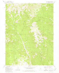
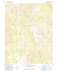
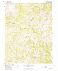
1980 Map of Toms Canyon
USGS Topo · Published 1980About this map
The Toiyabe Range dominates this portion of Nye County, where steep drainage systems and narrow canyons define the landscape within the Toiyabe National Forest. The map detail highlights a network of remote transportation routes, including a Jeep Trail and various stretches of Pack Trail that once served early prospectors and ranchers. Evidence of the region's mineral history is found at the Wall Canyon Mine, situated high above the canyon floor near a well and a seasonal Spring.
Find a feature on this map
23 named features on this map. Tap any name to fly to it.
Don’t see what you’re looking for? This feature index may not catch every label — zoom into the map to look around manually.
Map Details
Editions of this 1980 Toms Canyon Map
2 editions found
Other maps of this area

1907 · Tonopah
USGS Topo · 1:250,000

1908 · Tonopah
USGS Topo · 1:250,000

1956 · Tonopah
USGS Topo · 1:250,000

1959 · Tonopah
USGS Topo · 1:250,000

1962 · Tonopah
USGS Topo · 1:250,000
1971 · Carvers
USGS Topo · 1:24,000
1971 · Seyler Peak
USGS Topo · 1:24,000
1971 · Pablo Canyon Ranch
USGS Topo · 1:24,000
1980 · Arc Dome
USGS Topo · 1:24,000
1980 · Secret Basin
USGS Topo · 1:24,000