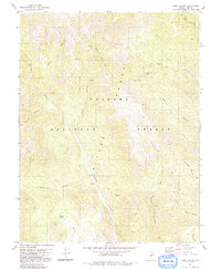
1980 Map of Toms Canyon
USGS Topo · Published 1991About this map
The Toiyabe Range dominates this landscape, its steep eastern and western slopes deeply incised by a network of drainage systems during the mid-1970s. The topography is defined by significant vertical relief, with Toms Canyon and Peavine Canyon running parallel to the central ridgelines. High-elevation resources such as Keough Spring and various unnamed Springs provide critical water points in this arid environment within the Toiyabe National Forest.
Find a feature on this map
23 named features on this map. Tap any name to fly to it.
Don’t see what you’re looking for? This feature index may not catch every label — zoom into the map to look around manually.
Map Details
Editions of this 1980 Toms Canyon Map
2 editions found
Other maps of this area

1907 · Tonopah
USGS Topo · 1:250,000

1908 · Tonopah
USGS Topo · 1:250,000

1956 · Tonopah
USGS Topo · 1:250,000

1959 · Tonopah
USGS Topo · 1:250,000

1962 · Tonopah
USGS Topo · 1:250,000

1971 · Carvers
USGS Topo · 1:24,000

1971 · Seyler Peak
USGS Topo · 1:24,000

1971 · Pablo Canyon Ranch
USGS Topo · 1:24,000
1980 · Arc Dome
USGS Topo · 1:24,000

1980 · Secret Basin
USGS Topo · 1:24,000