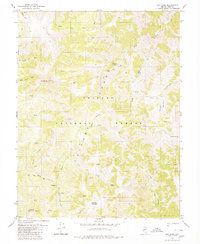
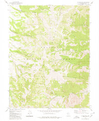
1980 Map of Arc Dome
USGS Topo · Published 1980About this map
Toiyabe National Forest dominates this high-altitude section of the Toiyabe Range, where the headwaters of the Reese River and numerous mountain streams carve deep canyons through the Nevada wilderness. The summit of Arc Dome serves as a central landmark for the region, overlooking a landscape defined by dramatic elevation changes and sparse human presence. Early resource extraction is evidenced by the Prospects scattered across the eastern slopes, while a single Upper Corral and a Radio Facility near Peavine Mountain represent the few functional structures in this remote territory.
Find a feature on this map
31 named features on this map. Tap any name to fly to it.
Don’t see what you’re looking for? This feature index may not catch every label — zoom into the map to look around manually.
Map Details
Editions of this 1980 Arc Dome Map
3 editions found
Other maps of this area

1907 · Tonopah
USGS Topo · 1:250,000

1908 · Tonopah
USGS Topo · 1:250,000

1956 · Tonopah
USGS Topo · 1:250,000

1959 · Tonopah
USGS Topo · 1:250,000

1962 · Tonopah
USGS Topo · 1:250,000

1971 · Carvers NW
USGS Topo · 1:24,000

1971 · Carvers
USGS Topo · 1:24,000

1971 · Pablo Canyon Ranch
USGS Topo · 1:24,000
1979 · Corral Wash
USGS Topo · 1:24,000
1979 · Toiyabe Peak
USGS Topo · 1:24,000