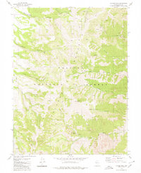
1979 Map of Toiyabe Peak
USGS Topo · Published 1980About this map
Toiyabe Peak dominates this high-altitude landscape in the late 1970s, where the steep canyons of the Toiyabe Range drop toward the Great Basin. This area within the Toiyabe National Forest preserves a history of mining and seasonal grazing, evidenced by high-mountain meadows like Mohawk Pasture and Werdenhoff Pasture. The map highlights the intersection of industrial pursuit and the natural environment, marking specific extraction points such as the Hamlin Mine and the Murphy Mine.
Find a feature on this map
28 named features on this map. Tap any name to fly to it.
Don’t see what you’re looking for? This feature index may not catch every label — zoom into the map to look around manually.
Map Details
Editions of this 1979 Toiyabe Peak Map
2 editions found
Other maps of this area

1907 · Tonopah
USGS Topo · 1:250,000

1908 · Tonopah
USGS Topo · 1:250,000

1955 · Millett
USGS Topo · 1:250,000

1956 · North Shoshone Peak
USGS Topo · 1:62,500

1956 · Millett Ranch
USGS Topo · 1:62,500

1956 · Tonopah
USGS Topo · 1:250,000

1959 · Tonopah
USGS Topo · 1:250,000

1959 · Millett
USGS Topo · 1:250,000

1962 · Tonopah
USGS Topo · 1:250,000

1971 · Carvers NW
USGS Topo · 1:24,000