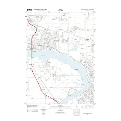
2013 Map of Tonawanda West
USGS Topo · Published 2013About this map
The Niagara River and its complex network of islands and creeks dominate this 2013 study of the borderlands near Niagara Falls. Dense residential grids in La Salle and Black Creek Village sit in stark contrast to the preserved marshes of Buckhorn Island and the open runways of the Niagara Falls International Airport. Notable for its inclusion of the Love Canal area, the map provides a precise layout of the neighborhoods and industrial interfaces of the early 21st century.
Find a feature on this map
154 named features on this map. Tap any name to fly to it.
Don’t see what you’re looking for? This feature index may not catch every label — zoom into the map to look around manually.
Map Details
Editions of this 2013 Tonawanda West Map
This is the sole edition of this map. No revisions or reprints were ever made.
Other maps of this area

1894 · Buffalo
USGS Topo · 1:62,500

1894 · Niagara Falls
USGS Topo · 1:62,500

1896 · Niagara Falls
USGS Topo · 1:62,500

1897 · Tonawanda
USGS Topo · 1:62,500

1899 · Niagara
USGS Topo · 1:125,000

1900 · Tonawanda
USGS Topo · 1:62,500

1900 · Niagara Falls
USGS Topo · 1:62,500

1901 · Buffalo
USGS Topo · 1:62,500

1901 · Niagara Falls
USGS Topo · 1:62,500

1901 · Tonawanda
USGS Topo · 1:62,500