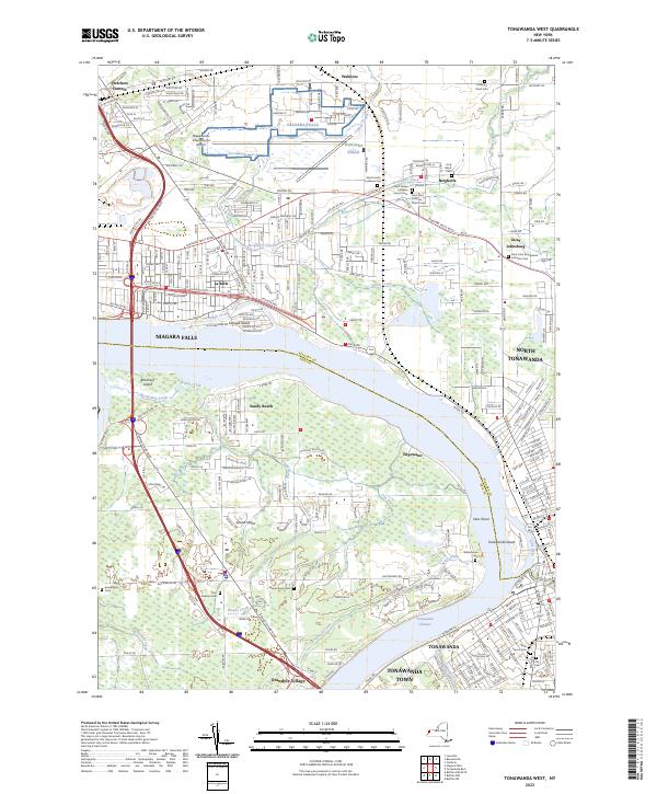
2023 Map of Tonawanda West
USGS Topo · Published 2023About this map
The Niagara River separates Niagara Falls and North Tonawanda from the residential and recreational landscapes of Grand Island. This modern survey details the complex waterway network where the river splits around Buckhorn Island and Tonawanda Island, creating the Tonawanda Channel and Little River. On the mainland, the map documents a density of German Lutheran heritage through established communities like Bergholtz and Saint Johnsburg, each anchored by historical burial grounds such as the Saint Paul Lutheran Church Cem and Saint John Evangelical Lutheran Cem. Along the southern shore of the island, Grandyle Village and Sandy Beach illustrate the transition from early riverfront settlements to modern residential centers. These labels provide essential coordinates for genealogists tracing family plots at the Holy Ghost Cem or researchers studying the evolution of the Niagara frontier's industrial and suburban borders.
Find a feature on this map
223 named features on this map. Tap any name to fly to it.
Don’t see what you’re looking for? This feature index may not catch every label — zoom into the map to look around manually.
Map Details
Editions of this 2023 Tonawanda West Map
This is the sole edition of this map. No revisions or reprints were ever made.
Other maps of this area

1894 · Buffalo
USGS Topo · 1:62,500

1894 · Niagara Falls
USGS Topo · 1:62,500

1896 · Niagara Falls
USGS Topo · 1:62,500

1897 · Tonawanda
USGS Topo · 1:62,500

1899 · Niagara
USGS Topo · 1:125,000

1900 · Tonawanda
USGS Topo · 1:62,500

1900 · Niagara Falls
USGS Topo · 1:62,500

1901 · Buffalo
USGS Topo · 1:62,500

1901 · Niagara Falls
USGS Topo · 1:62,500

1901 · Tonawanda
USGS Topo · 1:62,500