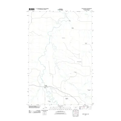
2011 Map of Toney Bench
USGS Topo · Published 2011About this map
Samples Crossing and the Judith River anchor this topographic view of Fergus County, Montana. The river carves a winding path through a landscape defined by elevated plateaus and deep drainage coulees, including Ming Coulee and Scotchman Coulee. Human activity is concentrated around the Samples Crossing Bridge and the Deerfield Colony to the southeast, while the broader terrain consists of distinct level expanses like Toney Bench and Seventytwo Bench. These geological formations, alongside landmarks like Indian Graves Butte and Sand Rock Hill, illustrate the erosion-carved geography of the central Montana plains. Local transit relies on established routes such as N Danvers Rd and Sandrock Rd, which navigate the elevation changes between the river basin and the flats of Marshall Flat.
Find a feature on this map
20 named features on this map. Tap any name to fly to it.
Don’t see what you’re looking for? This feature index may not catch every label — zoom into the map to look around manually.
Map Details
Editions of this 2011 Toney Bench Map
This is the sole edition of this map. No revisions or reprints were ever made.
Other maps of this area

1954 · Lewistown
USGS Topo · 1:250,000

1959 · Lewistown
USGS Topo · 1:250,000

1970 · Harwood Bench
USGS Topo · 1:24,000

1970 · Danvers
USGS Topo · 1:24,000

1970 · Spring Creek Junction
USGS Topo · 1:24,000
1978 · Soda Spring Coulee
USGS Topo · 1:24,000

1978 · Wild Bill Flat West
USGS Topo · 1:24,000

1978 · Toney Bench
USGS Topo · 1:24,000
1978 · Hoosac
USGS Topo · 1:24,000

1978 · Seventytwo Hills
USGS Topo · 1:24,000