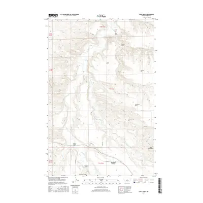
2017 Map of Toney Bench
USGS Topo · Published 2017About this map
Deerfield Colony sits on the western edge of the expansive benchlands in Fergus County, providing a clear view of the Hutterite communal settlement pattern in Central Montana. The landscape is defined by its drainage systems, including the headwaters of Willow Cr, which cuts through the high plains. This 2017 survey documents the modern agricultural footprint and rural infrastructure of the region, where isolated outposts and large-scale farming operations navigate the breaks and plateaus of the Missouri River watershed.
Find a feature on this map
2 named features on this map. Tap any name to fly to it.
Don’t see what you’re looking for? This feature index may not catch every label — zoom into the map to look around manually.
Map Details
Editions of this 2017 Toney Bench Map
This is the sole edition of this map. No revisions or reprints were ever made.
Other maps of this area

1954 · Lewistown
USGS Topo · 1:250,000

1959 · Lewistown
USGS Topo · 1:250,000

1970 · Harwood Bench
USGS Topo · 1:24,000

1970 · Danvers
USGS Topo · 1:24,000

1970 · Spring Creek Junction
USGS Topo · 1:24,000
1978 · Soda Spring Coulee
USGS Topo · 1:24,000

1978 · Wild Bill Flat West
USGS Topo · 1:24,000

1978 · Toney Bench
USGS Topo · 1:24,000
1978 · Hoosac
USGS Topo · 1:24,000

1978 · Seventytwo Hills
USGS Topo · 1:24,000