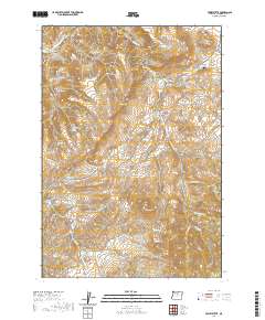
2020 Map of Toney Butte
USGS Topo · Published 2020About this map
Toney Butte rises prominently over a landscape defined by deep canyons and seasonal watercourses in this recent survey of Wheeler County. The northern boundary is marked by the winding path of the John Day River, which flows past Clark Canyon and Camel Hump. This area is characterized by significant topographic relief, from the heights of Keys Mtn to the unusual geological formation known as The Blue Banks.
Find a feature on this map
45 named features on this map. Tap any name to fly to it.
Don’t see what you’re looking for? This feature index may not catch every label — zoom into the map to look around manually.
Map Details
Editions of this 2020 Toney Butte Map
This is the sole edition of this map. No revisions or reprints were ever made.
Other maps of this area

1926 · Mitchell
USGS Topo · 1:125,000

1953 · Richmond
USGS Topo · 1:62,500

1953 · Spray
USGS Topo · 1:62,500

1955 · Bend
USGS Topo · 1:250,000

1955 · Canyon City
USGS Topo · 1:250,000

1957 · Bend
USGS Topo · 1:250,000

1958 · Bend
USGS Topo · 1:250,000

1959 · Canyon City
USGS Topo · 1:250,000

1966 · Mitchell
USGS Topo · 1:62,500

1966 · Kinzua
USGS Topo · 1:62,500