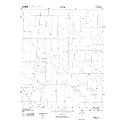
2010 Map of Toney
USGS Topo · Published 2010About this map
Toney Post Office and the surrounding agricultural landscape in Madison County are meticulously documented in this 2010 study of the Alabama-Tennessee border region. The area is characterized by a dense network of family-named cemeteries, such as the Madison Crossroads Cemetery, Golightly Cemetery, and Cole-Holloway Cemetery, which serve as vital markers for local genealogical research. The northern boundary is defined by State Line Rd, where the landscape transitions toward Scott's Orchard.
Find a feature on this map
85 named features on this map. Tap any name to fly to it.
Don’t see what you’re looking for? This feature index may not catch every label — zoom into the map to look around manually.
Map Details
Editions of this 2010 Toney Map
This is the sole edition of this map. No revisions or reprints were ever made.
Other maps of this area

1888 · Huntsville
USGS Topo · 1:125,000

1892 · Huntsville
USGS Topo · 1:125,000

1936 · Jeff
USGS Topo · 1:24,000

1936 · Capshaw
USGS Topo · 1:24,000

1936 · Taft
USGS Topo · 1:24,000

1936 · Meridianville
USGS Topo · 1:24,000

1936 · Fisk
USGS Topo · 1:24,000

1936 · Ardmore
USGS Topo · 1:24,000

1936 · Lincoln
USGS Topo · 1:24,000

1936 · Toney
USGS Topo · 1:24,000