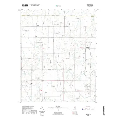
2020 Map of Toney
USGS Topo · Published 2020About this map
The Brier Fork Flint River winds through the northern reaches of Madison County, Alabama, defining a landscape of agricultural crossroads and small aviation hubs. This region, situated along the Tennessee state line, is marked by the community of Toney and the rural junction of Bobo. The map illustrates a high density of family and community burial sites, including the Golightly Cem, The Good Earth Burial Ground, and the Murphy Hill Cem. These landmarks, alongside numerous others like Ready Cem and Kincaid Cem, provide a detailed genealogical record for local families. Small airfields such as Elkwood Airpark and the Hazel Green Airport dot the terrain, reflecting the area's transition towards modern utility while maintaining its traditional identity at Madison Crossroads and Ready Crossing.
Find a feature on this map
150 named features on this map. Tap any name to fly to it.
Don’t see what you’re looking for? This feature index may not catch every label — zoom into the map to look around manually.
Map Details
Editions of this 2020 Toney Map
This is the sole edition of this map. No revisions or reprints were ever made.
Other maps of this area

1888 · Huntsville
USGS Topo · 1:125,000

1892 · Huntsville
USGS Topo · 1:125,000

1936 · Jeff
USGS Topo · 1:24,000

1936 · Capshaw
USGS Topo · 1:24,000

1936 · Taft
USGS Topo · 1:24,000

1936 · Meridianville
USGS Topo · 1:24,000

1936 · Fisk
USGS Topo · 1:24,000

1936 · Ardmore
USGS Topo · 1:24,000

1936 · Lincoln
USGS Topo · 1:24,000

1936 · Toney
USGS Topo · 1:24,000