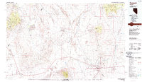
1987 Map of Tonopah
USGS Topo · Published 1987About this map
Tonopah serves as the central hub of this high-desert region, surrounded by a legacy of significant mining activity as shown in the late 1980s. The town sits at the crossroads of major transit routes, including Highway 95 and Highway 6, with its silver mining heritage evidenced by the Mizpah Mine and other nearby operations like the Cardinal Mine and Sullivan Mine. The landscape is dominated by expansive basins and ranges, including the Big Smoky Valley and the Monte Cristo Range, while more remote outposts like Millers, Gilbert, and Coaldale mark the surrounding terrain. Further west, the Columbus Salt Marsh provides a stark contrast to the mountainous backdrop of the Pilot Mountains, while the northeastern corner reaches into the high elevations of the Toiyabe National Forest. This survey captures the region's transition from a primary mining economy to an era of specialized land use, including the Tonopah Airport and various landing strips across the valleys.
Find a feature on this map
54 named features on this map. Tap any name to fly to it.
Don’t see what you’re looking for? This feature index may not catch every label — zoom into the map to look around manually.
Map Details
Editions of this 1987 Tonopah Map
2 editions found
Other maps of this area

1898 · Silver Peak
USGS Topo · 1:125,000

1900 · Silver Peak
USGS Topo · 1:125,000

1907 · Tonopah
USGS Topo · 1:250,000

1908 · Kawich
USGS Topo · 1:250,000

1908 · Lida
USGS Topo · 1:250,000

1908 · Tonopah
USGS Topo · 1:250,000

1909 · Hawthorne
USGS Topo · 1:250,000

1911 · Hawthorne
USGS Topo · 1:250,000

1913 · Lida
USGS Topo · 1:250,000

1915 · Hawthorne
USGS Topo · 1:250,000