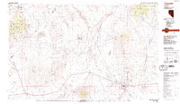
1987 Map of Tonopah
USGS Topo · Published 1987About this map
Tonopah serves as the focal point of this high-desert region, situated at the junction of the San Antonio Mountains and Ralston Valley. The landscape is defined by its deep mining heritage, with a concentration of workings such as Mizpah Hill, Mt Oddie, and the Golden Mine surrounding the townsite. To the west, the arid expanse includes Kibby Flat and the Columbus Salt Marsh, while the northern reaches transition into the Toiyabe National Forest.
Find a feature on this map
71 named features on this map. Tap any name to fly to it.
Don’t see what you’re looking for? This feature index may not catch every label — zoom into the map to look around manually.
Map Details
Editions of this 1987 Tonopah Map
2 editions found
Other maps of this area

1898 · Silver Peak
USGS Topo · 1:125,000

1900 · Silver Peak
USGS Topo · 1:125,000

1907 · Tonopah
USGS Topo · 1:250,000

1908 · Kawich
USGS Topo · 1:250,000

1908 · Lida
USGS Topo · 1:250,000

1908 · Tonopah
USGS Topo · 1:250,000

1909 · Hawthorne
USGS Topo · 1:250,000

1911 · Hawthorne
USGS Topo · 1:250,000

1913 · Lida
USGS Topo · 1:250,000

1915 · Hawthorne
USGS Topo · 1:250,000