
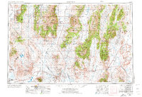
1956 Map of Tonopah
USGS Topo · Published 1974About this map
The Toiyabe Range and Monitor Range dominate this Nevada landscape, where mid-century mining interests and military installations underscore the region's industrial character. Centered on the silver-rich history of Tonopah, the map traces the intersection of Nye County and Esmeralda County. Mining activity is evident through sites like the Warrior Mine, Simon Mine, and the Gold Hill Mill, while the industrial past of the Columbus Salt Marsh is marked by Borax works (abandoned).
Find a feature on this map
89 named features on this map. Tap any name to fly to it.
Don’t see what you’re looking for? This feature index may not catch every label — zoom into the map to look around manually.
Map Details
Editions of this 1956 Tonopah Map
2 editions found
Other maps of this area

1898 · Silver Peak
USGS Topo · 1:125,000

1900 · Silver Peak
USGS Topo · 1:125,000

1907 · Tonopah
USGS Topo · 1:250,000

1908 · Kawich
USGS Topo · 1:250,000

1908 · Lida
USGS Topo · 1:250,000

1908 · Tonopah
USGS Topo · 1:250,000

1908 · Carson Sink
USGS Topo · 1:250,000

1909 · Hawthorne
USGS Topo · 1:250,000

1910 · Carson Sink
USGS Topo · 1:250,000

1911 · Hawthorne
USGS Topo · 1:250,000