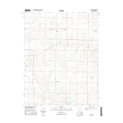
2015 Map of Tonovay
USGS Topo · Published 2015About this map
Tonovay and its surrounding prairie landscape are defined by a grid of rural township roads and the meandering path of the Fall River in this 2015 U.S. Geological Survey representation of Greenwood County. The settlement lies near the intersection of several key local routes, including Twp Rd 289 and Twp Rd 310, serving as a central point for the surrounding agricultural tracts. The terrain is etched by several prominent watercourses, most notably the Bachelor Cr and the namesake Tonovay Draw, which drain toward the larger river system to the south.
Find a feature on this map
28 named features on this map. Tap any name to fly to it.
Don’t see what you’re looking for? This feature index may not catch every label — zoom into the map to look around manually.
Map Details
Editions of this 2015 Tonovay Map
This is the sole edition of this map. No revisions or reprints were ever made.
Other maps of this area

1885 · Eureka
USGS Topo · 1:125,000

1888 · Eureka
USGS Topo · 1:125,000

1894 · Eureka
USGS Topo · 1:125,000

1939 · Severy
USGS Topo · 1:62,500

1941 · Severy
USGS Topo · 1:62,500

1955 · Wichita
USGS Topo · 1:250,000

1958 · Wichita
USGS Topo · 1:250,000
1964 · Piedmont NE
USGS Topo · 1:24,000
1969 · Neal
USGS Topo · 1:24,000
1969 · Virgil
USGS Topo · 1:24,000