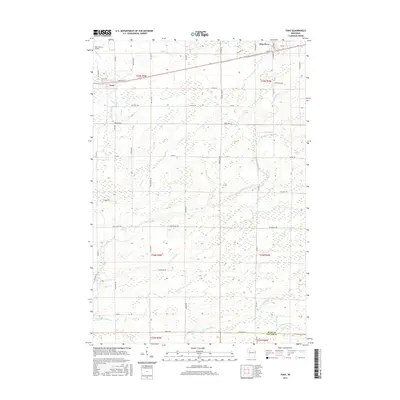
2015 Map of Tony
USGS Topo · Published 2015About this map
The village of Tony and the settlement of Glen Flora anchor this survey of northern Wisconsin's Rusk County. Located along a central transportation corridor defined by Stark Rd and Hanson Dr, these communities are surrounded by a landscape dominated by the complex drainage systems of the Jump and Flambeau river basins. Notable watercourses including the Little Jump River and Main Creek meander across the terrain, joined by smaller tributaries like Crazy Horse Cr and Skunk Cr. The northern portion of the map is punctuated by the Rusk County Airport, reflecting the area's modern infrastructure amidst its traditional rural setting. The grid of section lines and range markers, such as Range Line Rd, illustrates the organized public land survey system that shaped this part of the state, while numerous named roads like Deertail Rd provide access to the extensive wetland and stream networks.
Find a feature on this map
59 named features on this map. Tap any name to fly to it.
Don’t see what you’re looking for? This feature index may not catch every label — zoom into the map to look around manually.
Map Details
Editions of this 2015 Tony Map
This is the sole edition of this map. No revisions or reprints were ever made.
Other maps of this area

1944 · Exeland
USGS Topo · 1:48,000

1945 · Ingram
USGS Topo · 1:48,000

1947 · Exeland
USGS Topo · 1:48,000

1947 · Ingram
USGS Topo · 1:48,000

1947 · Sheldon
USGS Topo · 1:48,000

1948 · Ladysmith
USGS Topo · 1:48,000

1949 · Sheldon
USGS Topo · 1:48,000

1950 · Ladysmith
USGS Topo · 1:48,000

1953 · Rice Lake
USGS Topo · 1:250,000

1959 · Rice Lake
USGS Topo · 1:250,000