2022 Map of Tony
USGS Topo · Published 2022About this map
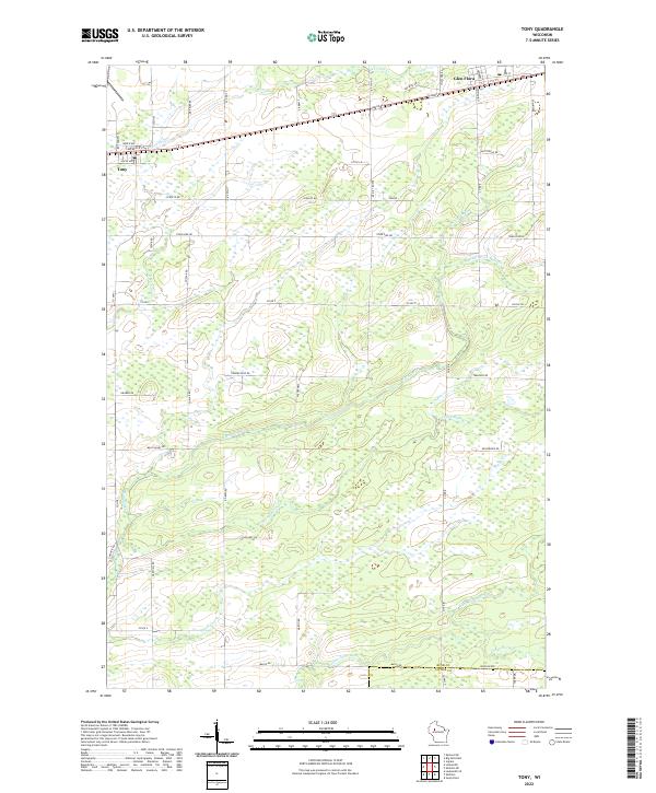
Tony and Glen Flora anchor the northern reaches of this rural Wisconsin landscape, positioned along a corridor of established local roads and the headwaters of numerous branching waterways. The terrain is characterized by a dense network of tributaries, including Deer Tail Cr and the complex system of the Main Creek, which splits into the S Fork Main Cr, W Fork Main Cr, and Middle Fork Main Cr. These streams flow through a region defined by a regular grid of county and township roads such as Co RD P, Main Valley Rd, and Town Line Rd. In the southeastern corner, the landscape descends toward the Little Jump River near the border of Rusk and Taylor counties, where Crazy Horse Cr joins the larger drainage. The map reveals a persistent pattern of rural settlement and agriculture, where the placement of farmsteads and access routes is dictated by the sprawling wetland basins and creek valleys.
Find a feature on this map
50 named features on this map. Tap any name to fly to it.
Don’t see what you’re looking for? This feature index may not catch every label — zoom into the map to look around manually.
Map Details
Editions of this 2022 Tony Map
This is the sole edition of this map. No revisions or reprints were ever made.
Historical Maps of Tony Through Time
2 maps found