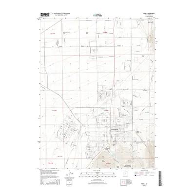
2014 Map of Tooele
USGS Topo · Published 2014About this map
Tooele stands at the base of the Oquirrh Mountains, where the urban grid meets the eastern slopes of the Tooele Valley. This 2014 survey captures a landscape defined by its proximity to both mountain canyons and regional transportation hubs. To the north, the smaller settlements of Erda and Lincoln occupy the transition from the valley floor to the foothills, while the Bolinder Field-Tooele Valley Airport and Erda Siding mark the area's ongoing connection to infrastructure and commerce.
Find a feature on this map
225 named features on this map. Tap any name to fly to it.
Don’t see what you’re looking for? This feature index may not catch every label — zoom into the map to look around manually.
Map Details
Editions of this 2014 Tooele Map
This is the sole edition of this map. No revisions or reprints were ever made.
Other maps of this area

1885 · Tooele Valley
USGS Topo · 1:250,000

1915 · Fairfield
USGS Topo · 1:62,500

1917 · Fairfield
USGS Topo · 1:62,500

1918 · Stockton
USGS Topo · 1:62,500

1952 · Bingham Canyon
USGS Topo · 1:24,000

1952 · Garfield
USGS Topo · 1:24,000

1953 · Tooele
USGS Topo · 1:250,000

1955 · Mills Junction
USGS Topo · 1:24,000

1955 · Burmester
USGS Topo · 1:24,000

1955 · Grantsville
USGS Topo · 1:24,000