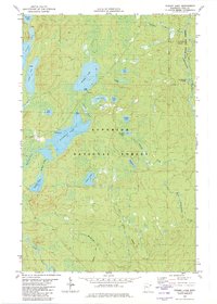
1981 Map of Toohey Lake
USGS Topo · Published 1982About this map
Superior National Forest and Pat Bayle State Forest encompass this corner of Cook County, where a dense network of glacial lakes and northern waterways defines the landscape. The hydrography here is complex, centered on large bodies like Fourmile Lake and Toohey Lake, which feed into various drainages including Toohey Creek and Fourmile Creek. The eastern portion of the sheet is dominated by the Temperance River corridor, featuring the Temperance River Campground and the prominent rise of Honeymoon Mountain. Evidence of early 1980s recreation and resource management is visible through a designated Snowmobile Trail and a Gravel Pit near the Cross River. The map details numerous smaller lakes with descriptive names such as Pancake Lake, Waffle Lake, and Wringer Lake, illustrating the unique topography of Minnesota's Arrowhead region before further modern development.
Find a feature on this map
34 named features on this map. Tap any name to fly to it.
Don’t see what you’re looking for? This feature index may not catch every label — zoom into the map to look around manually.
Map Details
Editions of this 1981 Toohey Lake Map
This is the sole edition of this map. No revisions or reprints were ever made.
Other maps of this area

1954 · Two Harbors
USGS Topo · 1:250,000

1955 · Tofte
USGS Topo · 1:24,000

1955 · Schroeder
USGS Topo · 1:24,000

1955 · Tofte
USGS Topo · 1:62,500

1955 · Cramer
USGS Topo · 1:62,500

1957 · Two Harbors
USGS Topo · 1:250,000

1958 · Two Harbors
USGS Topo · 1:250,000

1960 · Kawishiwi Lake
USGS Topo · 1:24,000

1960 · Sawbill Camp
USGS Topo · 1:24,000

1960 · Beth Lake
USGS Topo · 1:24,000