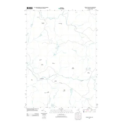
2013 Map of Tooley Pond
USGS Topo · Published 2013About this map
Newbridge and the remote Canton Farm anchor this high-relief landscape in the Adirondacks, where the S Br Grass River and Middle Br Grass River create a complex network of waterways. The terrain is defined by numerous named peaks such as Seaver Mountain, Oclare Mountain, and the curiously named Tunkethandle Hill. Hydrological features dominate the survey, highlighting several whitewater landmarks including Rainbow Falls, Copper Rock Falls, and the Brumagin Rapids. This 2013 snapshot captures the region's wilderness character, where isolated settlements are connected by the winding Tooley Pond Rd. The map provides detailed placement for several remote bodies of water like Slouch Pond, Parmeter Pond, and Wolf Pond, which are often difficult to locate in modern digital contexts without the benefit of this topographic detail.
Find a feature on this map
46 named features on this map. Tap any name to fly to it.
Don’t see what you’re looking for? This feature index may not catch every label — zoom into the map to look around manually.
Map Details
Editions of this 2013 Tooley Pond Map
This is the sole edition of this map. No revisions or reprints were ever made.
Other maps of this area

1915 · Russell
USGS Topo · 1:62,500

1916 · Oswegatchie
USGS Topo · 1:62,500

1918 · Russell
USGS Topo · 1:62,500

1918 · Oswegatchie
USGS Topo · 1:62,500

1919 · Cranberry Lake
USGS Topo · 1:62,500

1921 · Cranberry Lake
USGS Topo · 1:62,500

1921 · Stark
USGS Topo · 1:62,500

1923 · Stark
USGS Topo · 1:62,500

1931 · Cranberry Lake
USGS Topo · 1:62,500

1940 · Stark
USGS Topo · 1:62,500