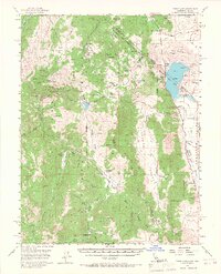
1956 Map of Topaz Lake
USGS Topo · Published 1967About this map
The Von Schmidt Line (1873) cuts across this high-country landscape, marking the historic boundary between California and Nevada in the mid-1950s. Mining activity is central to the area's development, evidenced by the large Leviathan Mine and several smaller operations like the Morningstar Mine and Curtz Mine in the northwest. These sites are linked by a network of winding roads including the Monitor Loop, which climbs toward Monitor Pass.
Find a feature on this map
79 named features on this map. Tap any name to fly to it.
Don’t see what you’re looking for? This feature index may not catch every label — zoom into the map to look around manually.
Map Details
Editions of this 1956 Topaz Lake Map
4 editions found

Other maps of this area

1889 · Markleeville
USGS Topo · 1:125,000

1891 · Markleeville
USGS Topo · 1:125,000

1891 · Wellington
USGS Topo · 1:125,000

1893 · Markleeville
USGS Topo · 1:125,000

1893 · Wellington
USGS Topo · 1:125,000

1896 · Dardanelles
USGS Topo · 1:125,000

1898 · Dardanelles
USGS Topo · 1:125,000

1909 · Bridgeport
USGS Topo · 1:125,000

1911 · Bridgeport
USGS Topo · 1:125,000

1920 · Bridgeport
USGS Topo · 1:125,000