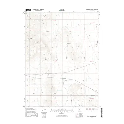
2014 Map of Topaz Mountain East
USGS Topo · Published 2014About this map
Topaz Mtn and the southeastern reaches of the Thomas Range anchor this 2014 survey of the desert landscape in Juab County. The topography is defined by significant elevation changes, from the heights of Antelope Ridge down to the broad expanses of Dugway Valley and Horse Valley. Water management and ephemeral drainage patterns are prominent, evidenced by the Greens Lake Debris Basin Number Three and various washes like Picture Rock Wash and Little Valley Wash. A network of unpaved roads and tracks, including the Joy Rd and Weiss Hwy, crisscrosses the terrain, while the Brush Beryllium road suggests the area's industrial or mining connections. This map provides a clear record of the access routes and named natural features surrounding the iconic Topaz Valley area.
Find a feature on this map
39 named features on this map. Tap any name to fly to it.
Don’t see what you’re looking for? This feature index may not catch every label — zoom into the map to look around manually.
Map Details
Editions of this 2014 Topaz Mountain East Map
This is the sole edition of this map. No revisions or reprints were ever made.
Other maps of this area

1885 · Sevier Desert
USGS Topo · 1:250,000

1908 · Fish Springs
USGS Topo · 1:250,000

1910 · Fish Springs
USGS Topo · 1:250,000

1953 · Dugway Pass
USGS Topo · 1:24,000

1953 · Dugway Range
USGS Topo · 1:62,500

1953 · Topaz Mtn
USGS Topo · 1:62,500

1953 · Delta
USGS Topo · 1:250,000

1958 · Delta
USGS Topo · 1:250,000

1962 · Delta
USGS Topo · 1:250,000

1971 · Picture Rock Hills
USGS Topo · 1:24,000