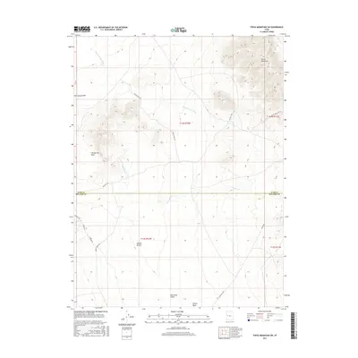
2017 Map of Topaz Mountain SW
USGS Topo · Published 2017About this map
Whirlwind Valley stretches across this arid landscape in eastern Millard County, bordered by the southern reaches of the Detroit Mountains. The area is defined by a complex network of ephemeral drainages, including the prominent Swasey Knolls Wash and Fish Springs Wash, which carve through the basin floor. The geography reveals a legacy of ranching and exploration, most notably at Swasey Bottom, a focal point for local movements and livestock management in this high desert environment.
Find a feature on this map
18 named features on this map. Tap any name to fly to it.
Don’t see what you’re looking for? This feature index may not catch every label — zoom into the map to look around manually.
Map Details
Editions of this 2017 Topaz Mountain SW Map
This is the sole edition of this map. No revisions or reprints were ever made.
Other maps of this area

1908 · Fish Springs
USGS Topo · 1:250,000

1910 · Fish Springs
USGS Topo · 1:250,000

1953 · Topaz Mtn
USGS Topo · 1:62,500

1953 · Delta
USGS Topo · 1:250,000

1958 · Delta
USGS Topo · 1:250,000

1962 · Delta
USGS Topo · 1:250,000

1967 · Sand Pass SE
USGS Topo · 1:24,000
1967 · Sand Pass NE
USGS Topo · 1:24,000
1972 · Swasey Peak
USGS Topo · 1:24,000
1972 · Little Drum Pass
USGS Topo · 1:24,000