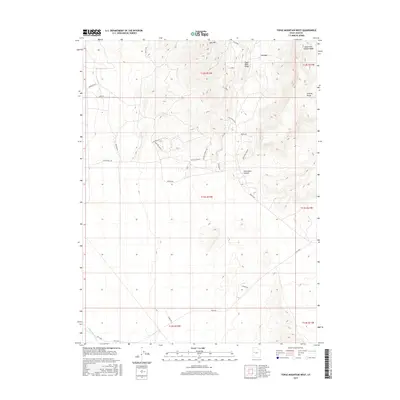
2017 Map of Topaz Mountain West
USGS Topo · Published 2017About this map
Spor Mtn and the Thomas Range anchor this high-desert landscape in Juab County, revealing a complex network of industrial and access roads established for mineral exploration and extraction. The 2017 terrain data highlights the transition from the rugged Eagle Rock Ridge down into the natural basin of The Dell. This area is defined by its mining-related infrastructure, with specialized routes like Gold Pot Road 1, Sling Shot Road 1, and Top Notch Road 1 carving through the slopes. Drainage patterns are captured through the South Fork Pispire Wash in the northeast and Swasey Knolls Wash to the southwest, illustrating the arid hydrology of the region. Local water sources are rare, marked only by isolated points like Brush Spr near Starvation Canyon, while the Brush Hwy and Weiss Hwy provide the primary transit corridors through this desert environment.
Find a feature on this map
32 named features on this map. Tap any name to fly to it.
Don’t see what you’re looking for? This feature index may not catch every label — zoom into the map to look around manually.
Map Details
Editions of this 2017 Topaz Mountain West Map
This is the sole edition of this map. No revisions or reprints were ever made.
Other maps of this area

1908 · Fish Springs
USGS Topo · 1:250,000

1910 · Fish Springs
USGS Topo · 1:250,000

1953 · Dugway Pass
USGS Topo · 1:24,000

1953 · Dugway Range
USGS Topo · 1:62,500

1953 · Topaz Mtn
USGS Topo · 1:62,500

1953 · Delta
USGS Topo · 1:250,000

1958 · Delta
USGS Topo · 1:250,000

1962 · Delta
USGS Topo · 1:250,000

1967 · Sand Pass SE
USGS Topo · 1:24,000

1967 · Fish Springs SE
USGS Topo · 1:24,000