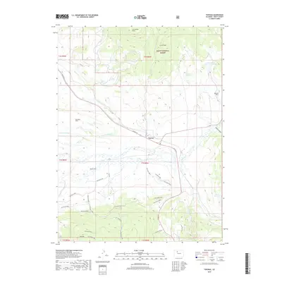
2019 Map of Toponas
USGS Topo · Published 2019About this map
The settlement of Toponas serves as the central hub of this high-country landscape, where the confluence of several creeks, including Egeria Cr and Toponas Cr, creates the wide, level basin of Egeria Park. The 2019 survey documents a complex system of water management essential to this ranching and forest region, featuring the Five Pine Mesa Ditch and numerous storage sites such as Crowner Reservoir and Kelly Reservoir. To the north and south, the terrain rises sharply toward the Routt National Forest, marked by the elevations of King Mtn and Lone Spring Butte. A network of Bureau of Land Management routes, such as BLM Route 8585 and the BLM King Mnt Rd, provides access to the backcountry, leading to remote landmarks like the King Mtn Cabin tucked away near the southern boundary.
Find a feature on this map
53 named features on this map. Tap any name to fly to it.
Don’t see what you’re looking for? This feature index may not catch every label — zoom into the map to look around manually.
Map Details
Editions of this 2019 Toponas Map
This is the sole edition of this map. No revisions or reprints were ever made.
Other maps of this area

1954 · Craig
USGS Topo · 1:250,000

1956 · Gore Pass
USGS Topo · 1:62,500

1957 · Craig
USGS Topo · 1:250,000

1957 · Leadville
USGS Topo · 1:250,000

1958 · Craig
USGS Topo · 1:250,000

1959 · Leadville
USGS Topo · 1:250,000

1960 · Leadville
USGS Topo · 1:250,000

1960 · Craig
USGS Topo · 1:250,000

1962 · Leadville
USGS Topo · 1:250,000

1962 · Craig
USGS Topo · 1:250,000