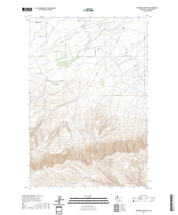
2023 Map of Toppenish Mountain
USGS Topo · Published 2023About this map
Toppenish Mtn and the adjacent Toppenish Ridge dominate the southern portion of this Yakima County landscape, marking the transition from the high ridges toward the agricultural expanses of the Yakima Valley to the north. The settlement of White Swan sits near the northwestern corner, serving as a focal point for the surrounding rural area. Water management is a central theme of the geography here, evidenced by the Unit 2 Canal and several drainages like Mill Creek and Toppenish Creek that descend from the slopes to support the valley floor.
Find a feature on this map
29 named features on this map. Tap any name to fly to it.
Don’t see what you’re looking for? This feature index may not catch every label — zoom into the map to look around manually.
Map Details
Editions of this 2023 Toppenish Mountain Map
This is the sole edition of this map. No revisions or reprints were ever made.
Other maps of this area

1937 · White Swan
USGS Topo · 1:125,000

1950 · Yakima
USGS Topo · 1:250,000

1958 · Toppenish Mtn.
USGS Topo · 1:24,000

1958 · Harrah
USGS Topo · 1:24,000

1958 · Fort Simcoe
USGS Topo · 1:24,000

1958 · Fort Simcoe
USGS Topo · 1:62,500

1958 · White Swan
USGS Topo · 1:24,000
1958 · Medicine Valley
USGS Topo · 1:24,000

1958 · Harrah SE
USGS Topo · 1:24,000

1958 · Yakima
USGS Topo · 1:250,000