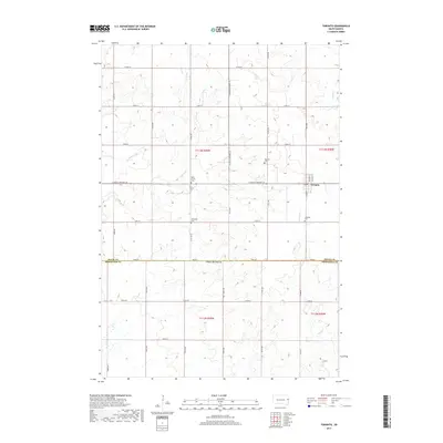
2017 Map of Toronto
USGS Topo · Published 2017About this map
The town of Toronto serves as a focal point in this eastern South Dakota landscape, situated along the northern edge of the Deuel Co Brookings Co line. This region, characterized by the prominent landform of the Coteau des Prairies, is defined by its agricultural grid and a series of rural cemeteries that mark the history of its local settlements. The map identifies several of these important genealogical sites, including the Toronto Cem, Blom Prairie Cem, Mikkelson Cem, and Leganger Cem, scattered across the townships. Waterways such as Peg Munky Run and N Deer Cr carve through the prairie, feeding into larger systems like Cobb Cr and Sixmile Cr. This 2017 survey by the U.S. Geological Survey captures the enduring rural character of the area where S Dakota Highway 15 and S Dakota Highway 28 intersect.
Find a feature on this map
34 named features on this map. Tap any name to fly to it.
Don’t see what you’re looking for? This feature index may not catch every label — zoom into the map to look around manually.
Map Details
Editions of this 2017 Toronto Map
This is the sole edition of this map. No revisions or reprints were ever made.
Other maps of this area

1953 · Watertown
USGS Topo · 1:250,000

1958 · Watertown
USGS Topo · 1:250,000

1968 · Brookings NE
USGS Topo · 1:24,000

1970 · Brandt
USGS Topo · 1:24,000

1970 · White NE
USGS Topo · 1:24,000

1970 · Astoria
USGS Topo · 1:24,000

1970 · White
USGS Topo · 1:24,000

1970 · Clear Lake South
USGS Topo · 1:24,000

1970 · Estelline SE
USGS Topo · 1:24,000

1970 · Estelline NE
USGS Topo · 1:24,000