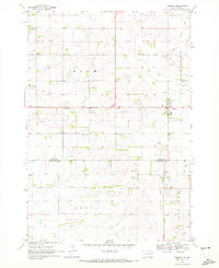
1970 Map of Toronto
USGS Topo · Published 1972About this map
Toronto serves as the central hub of this prairie landscape at the junction of the Bloom, Scandia, and Argo townships. The map reveals a deeply settled agricultural region defined by an extensive network of cemeteries, including Blom Prairie Cem, Mikkelson Cem, Toronto Cem, and Leganger Cem, which reflect the community's ancestral roots in the late nineteenth and early twentieth centuries.
Find a feature on this map
18 named features on this map. Tap any name to fly to it.
Don’t see what you’re looking for? This feature index may not catch every label — zoom into the map to look around manually.
Map Details
Editions of this 1970 Toronto Map
This is the sole edition of this map. No revisions or reprints were ever made.
Other maps of this area

1953 · Watertown
USGS Topo · 1:250,000
1958 · Watertown
USGS Topo · 1:250,000
1968 · Brookings NE
USGS Topo · 1:24,000
1970 · Brandt
USGS Topo · 1:24,000
1970 · White NE
USGS Topo · 1:24,000
1970 · Astoria
USGS Topo · 1:24,000
1970 · White
USGS Topo · 1:24,000
1970 · Clear Lake South
USGS Topo · 1:24,000
1970 · Estelline SE
USGS Topo · 1:24,000
1970 · Estelline NE
USGS Topo · 1:24,000