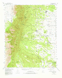
1954 Map of Torreon
USGS Topo · Published 1976About this map
The Manzano Mountains dominate this 1954 landscape, defined by a complex network of steep canyons and high-elevation peaks including Marzano Peak, Osha Peak, and Capilla Peak. This survey captures the eastern slopes where the high forest meets the agricultural and grazing lands of the Estancia Valley. The transition from the rugged Cibola National Forest to the valley floor is marked by several significant historic land grants, such as the Town of Tajique Grant and the Town of Manzano Grant.
Find a feature on this map
97 named features on this map. Tap any name to fly to it.
Don’t see what you’re looking for? This feature index may not catch every label — zoom into the map to look around manually.
Map Details
Editions of this 1954 Torreon Map
2 editions found

Other maps of this area

1916 · La Joya
USGS Topo · 1:125,000

1917 · Estancia
USGS Topo · 1:125,000

1952 · Tome SE
USGS Topo · 1:24,000

1952 · Tome NE
USGS Topo · 1:24,000

1952 · Los Lunas SE
USGS Topo · 1:24,000

1952 · Becker
USGS Topo · 1:24,000

1954 · Bosque Peak
USGS Topo · 1:24,000

1954 · Capilla Peak
USGS Topo · 1:24,000

1954 · Torreon
USGS Topo · 1:24,000

1954 · Tajique
USGS Topo · 1:24,000