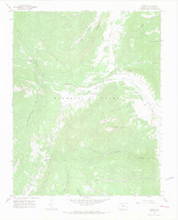
1967 Map of Torres
USGS Topo · Published 1971About this map
The South Fork Purgatoire River winds through the high canyons of Las Animas County, where the legacy of the Maxwell Grant shaped local land use in the late 1960s. The small settlements of Torres and Tercio represent a landscape defined by resource extraction and high-altitude ranching. Industrial evidence is found at the Cornell Mine and Quatro Mine, while the Tercio Cem and the Old Railroad Grade provide tangible links for genealogists and industrial historians. Extensive irrigation efforts are visible through the Consolidated Ditch and Quatro Ditch, which redirect water through the valleys of Stonewall Valley and South Valley. To the south, the terrain steepens significantly toward San Francisco Pass, where the North Fork Vermejo River and Canadian River originate near the geological prominence of The Little Wall.
Find a feature on this map
39 named features on this map. Tap any name to fly to it.
Don’t see what you’re looking for? This feature index may not catch every label — zoom into the map to look around manually.
Map Details
Editions of this 1967 Torres Map
4 editions found
Other maps of this area

1891 · Spanish Peaks
USGS Topo · 1:125,000

1893 · Spanish Peaks
USGS Topo · 1:125,000

1895 · Spanish Peaks
USGS Topo · 1:125,000

1897 · Spanish Peaks
USGS Topo · 1:125,000

1900 · Spanish Peaks
USGS Topo · 1:125,000

1954 · Raton
USGS Topo · 1:250,000

1954 · Trinidad
USGS Topo · 1:250,000

1955 · Trinidad
USGS Topo · 1:250,000

1958 · Raton
USGS Topo · 1:250,000

1958 · Trinidad
USGS Topo · 1:250,000