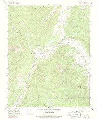
1967 Map of Torres
USGS Topo · Published 1986About this map
Maxwell Grant dominates the central landscape of this Colorado survey, illustrating the complex land tenure of the Sangre de Cristo foothills in the late 1960s. The settlement of Torres sits at the confluence where the South Fork joins the Purgatoire River, serving as a focal point for a network of irrigation systems including the Consolidated Ditch and Quatro Ditch. These waterworks, tracing the river valleys, highlight the region's reliance on managed water for agriculture and livestock.
Find a feature on this map
38 named features on this map. Tap any name to fly to it.
Don’t see what you’re looking for? This feature index may not catch every label — zoom into the map to look around manually.
Map Details
Editions of this 1967 Torres Map
4 editions found
Other maps of this area

1891 · Spanish Peaks
USGS Topo · 1:125,000

1893 · Spanish Peaks
USGS Topo · 1:125,000

1895 · Spanish Peaks
USGS Topo · 1:125,000

1897 · Spanish Peaks
USGS Topo · 1:125,000

1900 · Spanish Peaks
USGS Topo · 1:125,000

1954 · Raton
USGS Topo · 1:250,000

1954 · Trinidad
USGS Topo · 1:250,000

1955 · Trinidad
USGS Topo · 1:250,000

1958 · Raton
USGS Topo · 1:250,000

1958 · Trinidad
USGS Topo · 1:250,000