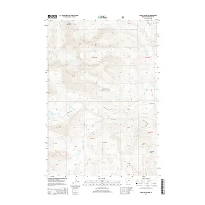
2014 Map of Torrey Mountain
USGS Topo · Published 2014About this map
Beaverhead National Forest encompasses this high-elevation landscape within the Pioneer Mountains, where sharp peaks and glacial basins define the topography. The terrain is anchored by several prominent summits including Tweedy Mtn, Torrey Mtn, and Barb Mtn. A complex network of alpine lakes, such as Glacier Lake, Minneopa Lake, and Gorge Lakes, feeds numerous drainage systems. These include the headwaters of Birch Creek and Rattlesnake Creek, which cut through deep valleys like Sawlog Gulch. While the area remains largely undeveloped, seasonal access is provided by primitive routes such as Birch Creek Rd and Mule Creek Rd, which wind through the lower elevations and connect the various mountain drainages. This survey captures the region's character as a site of natural water storage and high-mountain relief in Beaverhead County.
Find a feature on this map
55 named features on this map. Tap any name to fly to it.
Don’t see what you’re looking for? This feature index may not catch every label — zoom into the map to look around manually.
Map Details
Editions of this 2014 Torrey Mountain Map
This is the sole edition of this map. No revisions or reprints were ever made.
Other maps of this area

1893 · Dillon
USGS Topo · 1:250,000

1952 · Twin Adams Mountain
USGS Topo · 1:24,000

1952 · Argenta
USGS Topo · 1:24,000

1952 · Torrey Mountain
USGS Topo · 1:24,000

1952 · Ermont
USGS Topo · 1:24,000

1955 · Dillon
USGS Topo · 1:250,000

1957 · Dillon
USGS Topo · 1:250,000

1958 · Dillon
USGS Topo · 1:250,000

1958 · Vipond Park
USGS Topo · 1:62,500

1959 · Polaris
USGS Topo · 1:62,500