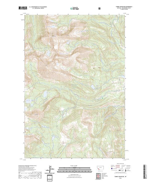
2024 Map of Torrey Mountain
USGS Topo · Published 2024About this map
The high peaks of the Pioneer Mountains define this section of the Beaverhead National Forest, where steep ridgelines reach their apex at summits like Tweedy Mtn and Torrey Mtn. This landscape is characterized by a dense network of glacial basins and high-altitude water bodies, including the Gorge Lakes to the north and the clustered Twin Lakes, Minneopa Lake, and Boatman Lake in the southern reaches. The drainage patterns show water moving through deep incisions like Sawlog Gulch and along Rattlesnake Creek. Human access is primarily limited to primitive corridors such as Birch Creek Rd and Mule Creek Rd, reflecting a wilderness area managed for its natural resources and watershed value. The survey detail highlights the intricate topography of the Eastern Pioneers, showing the transition from high alpine lake basins to the timbered slopes that feed into the larger river systems of Beaverhead County.
Find a feature on this map
52 named features on this map. Tap any name to fly to it.
Don’t see what you’re looking for? This feature index may not catch every label — zoom into the map to look around manually.
Map Details
Editions of this 2024 Torrey Mountain Map
This is the sole edition of this map. No revisions or reprints were ever made.
Other maps of this area

1893 · Dillon
USGS Topo · 1:250,000

1952 · Twin Adams Mountain
USGS Topo · 1:24,000

1952 · Argenta
USGS Topo · 1:24,000

1952 · Torrey Mountain
USGS Topo · 1:24,000

1952 · Ermont
USGS Topo · 1:24,000

1955 · Dillon
USGS Topo · 1:250,000

1957 · Dillon
USGS Topo · 1:250,000

1958 · Dillon
USGS Topo · 1:250,000

1958 · Vipond Park
USGS Topo · 1:62,500

1959 · Polaris
USGS Topo · 1:62,500