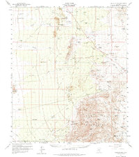
1959 Map of Tortolita Mts
USGS Topo · Published 1985About this map
The Tortolita Mountains anchor this arid landscape of the late 1950s, where the high desert is defined by a network of ephemeral washes and isolated peaks. Water management is the primary marker of human activity, as evidenced by numerous named wells and tanks like Sutton Well, Blue Ribbon Tank, and Magma Well. These features were critical for the sprawling ranching operations found across the valley, including Cross Triangle Ranch and Rancho Escondido.
Find a feature on this map
70 named features on this map. Tap any name to fly to it.
Don’t see what you’re looking for? This feature index may not catch every label — zoom into the map to look around manually.
Map Details
Editions of this 1959 Tortolita Mts Map
4 editions found

Other maps of this area

1904 · Tucson
USGS Topo · 1:125,000

1905 · Tucson
USGS Topo · 1:125,000

1911 · Winkelman
USGS Topo · 1:125,000

1913 · Winkelman
USGS Topo · 1:125,000

1922 · Red Rock No 2
USGS Topo · 1:48,000

1934 · Tucson Mountains
USGS Topo · 1:125,000

1934 · Newman Peak
USGS Topo · 1:125,000

1947 · Cortaro
USGS Topo · 1:62,500

1947 · Red Rock
USGS Topo · 1:62,500

1949 · Winkelman
USGS Topo · 1:62,500