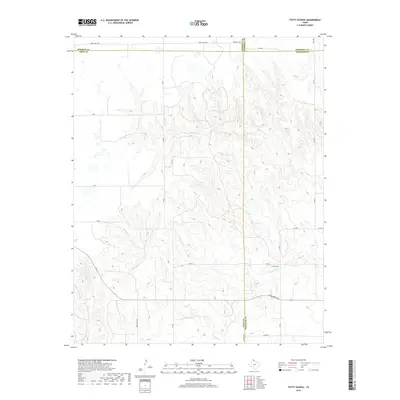
2019 Map of Totty School
USGS Topo · Published 2019About this map
Totty School serves as a lone landmark in this high-plains landscape of the Texas Panhandle, situated near the intersection of several remote county roads. The terrain is defined by the erosive action of intermittent waterways, most notably Sweetwater Cr, Cowboy Creek, and Graham Cr, which carve through the plains. This 2019 survey documents the rural infrastructure at the convergence of four counties: Gray, Wheeler, Hemphill, and Roberts. The map reveals a sparse network of ranching routes like Ranch Rd 1268 and Farm Rd 1268, reflecting the area's continued focus on large-scale agriculture and land management rather than concentrated urban development. Notable local passages such as W Oklahoma Ave and Co Rd 1 provide access to the vast ranch lands between these seasonal creek beds.
Find a feature on this map
25 named features on this map. Tap any name to fly to it.
Don’t see what you’re looking for? This feature index may not catch every label — zoom into the map to look around manually.
Map Details
Editions of this 2019 Totty School Map
This is the sole edition of this map. No revisions or reprints were ever made.
Other maps of this area

1954 · Amarillo
USGS Topo · 1:250,000

1958 · Amarillo
USGS Topo · 1:250,000

1962 · Pond Creek
USGS Topo · 1:24,000

1962 · Spring Creek
USGS Topo · 1:24,000

1962 · Pond Creek NW
USGS Topo · 1:24,000

1963 · Mobeetie
USGS Topo · 1:24,000

1966 · Laketon
USGS Topo · 1:24,000

1967 · Young Ranch
USGS Topo · 1:24,000

1967 · Tody School
USGS Topo · 1:24,000

1967 · Lora
USGS Topo · 1:24,000