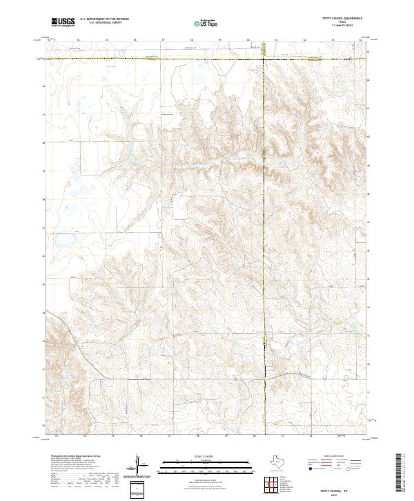
2022 Map of Totty School
USGS Topo · Published 2022About this map
High plains terrain defines this corner of the Texas Panhandle, where the boundaries of Gray, Wheeler, Roberts, and Hemphill counties converge. The landscape is deeply incised by the drainage systems of Sweetwater Cr and Cowboy Creek, revealing the characteristic broken ground that interrupts the surrounding level ranchlands. These intermittent waterways and their tributary draws, such as Graham Cr, dictate the sparse road network of the region.
Find a feature on this map
25 named features on this map. Tap any name to fly to it.
Don’t see what you’re looking for? This feature index may not catch every label — zoom into the map to look around manually.
Map Details
Editions of this 2022 Totty School Map
This is the sole edition of this map. No revisions or reprints were ever made.
Other maps of this area

1954 · Amarillo
USGS Topo · 1:250,000

1958 · Amarillo
USGS Topo · 1:250,000

1962 · Pond Creek
USGS Topo · 1:24,000

1962 · Spring Creek
USGS Topo · 1:24,000

1962 · Pond Creek NW
USGS Topo · 1:24,000

1963 · Mobeetie
USGS Topo · 1:24,000

1966 · Laketon
USGS Topo · 1:24,000

1967 · Young Ranch
USGS Topo · 1:24,000

1967 · Tody School
USGS Topo · 1:24,000

1967 · Lora
USGS Topo · 1:24,000