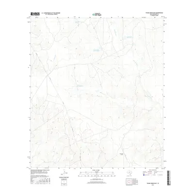
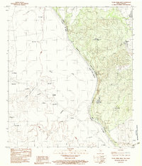
2016 Map of Tovar Creek East
USGS Topo · Published 2016About this map
Tovar Creek and its surrounding drainage systems define this landscape in Maverick County, where a network of ranching reservoirs supports the local ecology. The map features several named impoundments including Tovar Ranch Lake Number 1, Tovar Ranch Lake Number 2, and Tovar Ranch Lake Number 3, alongside Cage Lake Number 1 to the north. These man-made features highlight the essential role of water management in this arid region of South Texas. Connectivity across the brushland is maintained by FM 1021, which serves as the primary artery for the area. In the southern portion of the quadrangle, the Indio-Faith Airport provides a remote aviation waypoint, while seasonal watercourses like San Ambrosia Cr and Borrego Cr trace the natural topography between ranch boundaries.
Find a feature on this map
9 named features on this map. Tap any name to fly to it.
Don’t see what you’re looking for? This feature index may not catch every label — zoom into the map to look around manually.
Map Details
Editions of this 2016 Tovar Creek East Map
This is the sole edition of this map. No revisions or reprints were ever made.
Other maps of this area

1940 · Chupadera
USGS Topo · 1:62,500

1941 · Botella Creek
USGS Topo · 1:62,500

1957 · Indio Creek
USGS Topo · 1:62,500

1957 · Botella Creek
USGS Topo · 1:62,500

1958 · Eagle Pass
USGS Topo · 1:250,000

1965 · Eagle Pass
USGS Topo · 1:250,000
1982 · Tovar Creek East
USGS Topo · 1:24,000
1982 · Indio Tank
USGS Topo · 1:24,000
1982 · San Pedro Creek
USGS Topo · 1:24,000
1983 · Tovar Creek West
USGS Topo · 1:24,000