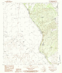
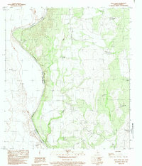
1983 Map of Tovar Creek West
USGS Topo · Published 1983About this map
The Rio Grande Rio Bravo serves as the central artery and international boundary on this 1983 provisional survey of the borderlands between Maverick County, Texas, and Coahuila, Mexico. The landscape is defined by the drainage patterns of Tovar Creek and Cuervo Creek, which cut through a terrain dotted with water-management features essential for ranching, such as Bueno Aqua Tank, Mansfield Tank, and Rock Tank.
Find a feature on this map
34 named features on this map. Tap any name to fly to it.
Don’t see what you’re looking for? This feature index may not catch every label — zoom into the map to look around manually.
Map Details
Editions of this 1983 Tovar Creek West Map
This is the sole edition of this map. No revisions or reprints were ever made.
Other maps of this area

1940 · Chupadera
USGS Topo · 1:62,500

1941 · Botella Creek
USGS Topo · 1:62,500

1957 · Indio Creek
USGS Topo · 1:62,500

1957 · Botella Creek
USGS Topo · 1:62,500

1958 · Eagle Pass
USGS Topo · 1:250,000

1965 · Eagle Pass
USGS Topo · 1:250,000
1982 · Tovar Creek East
USGS Topo · 1:24,000
1982 · Indio Tank
USGS Topo · 1:24,000
1983 · Salt Well
USGS Topo · 1:24,000
1983 · Indio Creek
USGS Topo · 1:24,000