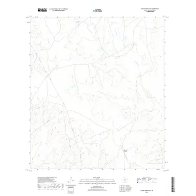
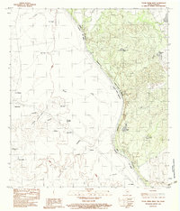
2019 Map of Tovar Creek East
USGS Topo · Published 2019About this map
San Ambrosia Creek and Tovar Creek wind through this corner of the South Texas brush country, defining a landscape dominated by ranching operations and water management. Modern infrastructure is anchored by FM 1021, which cuts a straight path through the undulating terrain toward the Rio Grande valley. Local water resources are managed through significant catchment systems like Cage Lake Number 1 and Tovar Ranch Lake Number 3, which are essential for livestock in this arid environment. The presence of the Indio-Faith Airport in the southeastern quadrant suggests the area's utility for private aviation, supporting large-scale landholdings and regional transport. Sparse drainage patterns from Borrego Creek further illustrate the seasonal nature of the waterways that have long shaped the ranching boundaries and economic life of Maverick County.
Find a feature on this map
7 named features on this map. Tap any name to fly to it.
Don’t see what you’re looking for? This feature index may not catch every label — zoom into the map to look around manually.
Map Details
Editions of this 2019 Tovar Creek East Map
This is the sole edition of this map. No revisions or reprints were ever made.
Other maps of this area

1940 · Chupadera
USGS Topo · 1:62,500

1941 · Botella Creek
USGS Topo · 1:62,500

1957 · Indio Creek
USGS Topo · 1:62,500

1957 · Botella Creek
USGS Topo · 1:62,500

1958 · Eagle Pass
USGS Topo · 1:250,000

1965 · Eagle Pass
USGS Topo · 1:250,000
1982 · Tovar Creek East
USGS Topo · 1:24,000
1982 · Indio Tank
USGS Topo · 1:24,000
1982 · San Pedro Creek
USGS Topo · 1:24,000
1983 · Tovar Creek West
USGS Topo · 1:24,000