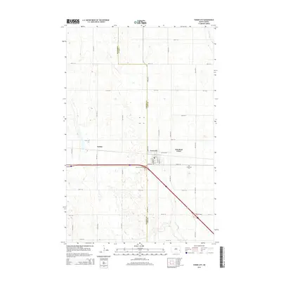
2014 Map of Tower City
USGS Topo · Published 2014About this map
Tower City straddles the county line dividing Barnes Co and Cass Co in eastern North Dakota, serving as a primary settlement along the interstate corridor. The town layout is clearly defined by historical street names such as Church St, Broadway St, and Maiden Ln, reflecting its established residential and commercial grid. To the east, the Wheatland Colony and Koldok represent distinct settlement patterns within the agricultural landscape. The presence of Greenwood Cem southeast of the main town site offers a specific point of interest for genealogists tracing local families. The terrain is characterized by a high concentration of small wetlands and depressions typical of the prairie pothole region, with the Maple River cutting through the northeast corner of the survey. Significant infrastructure, including the Tower City Interchange and Hill Interchange, illustrates the region's modern reliance on high-speed transportation networks.
Find a feature on this map
31 named features on this map. Tap any name to fly to it.
Don’t see what you’re looking for? This feature index may not catch every label — zoom into the map to look around manually.
Map Details
Editions of this 2014 Tower City Map
This is the sole edition of this map. No revisions or reprints were ever made.
Other maps of this area

1897 · Tower
USGS Topo · 1:125,000

1952 · Grand Forks
USGS Topo · 1:250,000

1953 · Fargo
USGS Topo · 1:250,000

1956 · Fargo
USGS Topo · 1:250,000

1956 · Grand Forks
USGS Topo · 1:250,000

1965 · Alice
USGS Topo · 1:24,000

1965 · Tower City SW
USGS Topo · 1:24,000

1966 · Grand Forks
USGS Topo · 1:250,000

1967 · Tower City
USGS Topo · 1:24,000

1967 · Pillsbury SE
USGS Topo · 1:24,000